Cycling in the Snowdonia National Park
& the Llŷn Peninsula

The Eryri/Snowdonia National Park on the north west corner of Wales is a dramatic mixture of Celtic culture and coastal spectacle, set against a backdrop of rugged mountain scenery. Mount Snowdon [Yr Wyddfa in Welsh], the highest mountain in England and Wales, is a mere 1,085m high but what makes the Snowdonia range look really dramatic is the fact that it rises straight up from sea level. In 2022 the Park Authority voted to use the Welsh Yr Wyddfa and Eryri rather than the English Snowdon and Snowdonia.

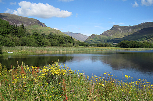
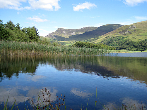
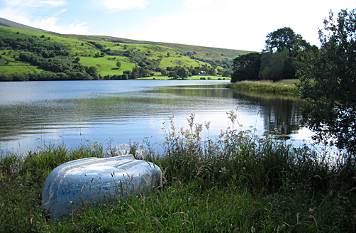
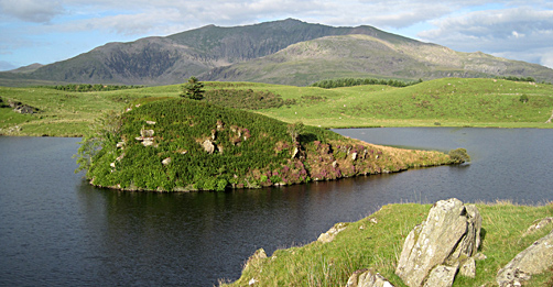
A Lake in the Nantlle Valley
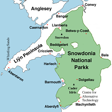
Where Are We?
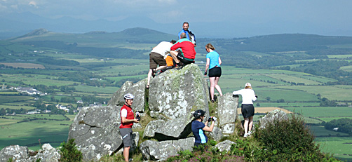
A Bike Ride to Hell's Mouth

Above photo: Cyclists looking down on Hell's Mouth beach from a lane on the east side of Mynydd Rhiw [mynydd means mountain and rhiw means hill, which is a bit over the top]. We prefer cycling up this lane to the Sustrans route on the west side of Mynydd Rhiw - steeper but the views are better and you can climb the rock outcrop below...
There are some great beaches on the Llŷn Peninsula like this one at Aberdaron...

If you've gone this far down the Llŷn Peninsula, then it would be a pity not to cycle along the backwater lane via the hamlet of Anelog (west of Aberdaron), and also via Uwchmynydd out to the end of the peninsula. At the end of the tarmac, follow the concrete road up to the old coastguard lookout for the best view of Bardsey Island. It is said that 5,000 saints are buried on Bardsey (maybe they are all in that mound on the island).

Cycling back down you get a 360° view of much of the Welsh coast...

The Whistling Sands

The National Trust beach at Porth Ore is also called ‘Whistling Sands’. If you slide your feet through the dry sand it squeaks or whistles. Dr Alice Roberts investigates…
Just remember to dismount as you approach the beach - the lane ends suddenly with a drop. There is a cafe on the beach.
The Whale in the Lake
Near the village of Rhyd Ddu is a whale stranded in a small lake (Llyn y Dywarchen, map ref: 560 534). That's Snowdon (Yr Wyddfa) in the background.
And would you believe that just down the road is a giant elephant drinking from Llyn Cwellyn. A good view of it is from the Snowdonia Parc pub in Waunfawr - when you come out of the pub door there it is right in front of you...
Love Slate
You might think you're not interested in slate but this area once 'roofed the world'. As you cycle around you'll notice the old slate quarries. Then you'll look closer and you'll notice the colours on the slate slag heaps (especially after rain). And before you know it, you'll fall in love with slate and start searching out old quarries such as the Dorothea Quarry between Talysarn and Nantlle in the Nantlle Valley [Cwm Nantlle]...
The Dorothea Quarry and surroundings are extremely dangerous so don't cycle, climb or swim (actually private land). Since the quarry ended operations in the 1970s it has flooded to a depth of 106m which makes it a magnet for extreme divers from all over the UK. Known locally as "the pool of death", 25 divers have died here since 1990 (tunnels, old machinery and darkness make it a dangerous dive). The next video by diver Artur Jablonski reveals the surreal 'post-apocalyptic' underwater world of the drowned quarry (note the "This is a smoke free building" sign at 2.12).
The photo below shows the Cwmystradllyn slate mill (map ref: 550 433) which was an early attempt at mechanising the spitting of slates. It failed. Now the mill stands in the middle of nowhere like a ruined cathedral. Well worth a visit, and if you do we'd recommend a ride up the nearby Pennant Valley [Cwm Pennant] - it's a dead end but well worth doing in both directions.

When the slate bug has bitten, you'll want to cycle over to the National Slate Museum in Llanberis. Part of the National Museum of Wales, the museum (free) is housed in the 19th-century workshops of the Dinorwic slate quarry which closed in 1969. The workshops produced everything the quarry needed, even the cogs for the trains that carried the finished slates down to the coast at Y Felinheli; and was powered by the largest working water wheel in Britain. Video showing the incline working in 2012. Video exploring the hidden bits of the quarry. Before cycling away, make sure you also visit the Vivian Quarry (through the archway behind a building with "Vivian" on it).
Criccieth
Criccieth is the prettiest seaside town on the Llŷn Peninsula (see photo at top of page). Easy to get to by rail; the trip along the Mid Wales Line from Shrewsbury is a real treat, especially where it hugs the coast after Machynlleth.


"Lloyd George Knew..."
Lloyd George, the 1st World War British prime minister, grow up as a Welsh-speaker in the village of Llanystumdwy (west of Criccieth) - he is the only UK prime minister to have spoken English as a second language. Sustrans' cycle route 4 goes along a lane right past his grave which was designed by Clough Williams-Ellis, he of Portmeiron fame Well worth getting of your bike for - note the details in the path etc.
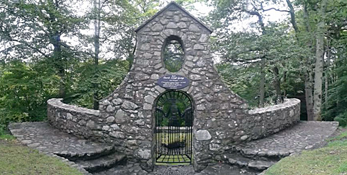

Location: The grave is hidden in pretty woodland opposite the rear gates to the Lloyd George Museum (by the "30" mile speed limit signs) on the eastern edge of Llanystumdwy. There are usually a few cars parked by the entrance in the low wall to the woods.
Beddgelert
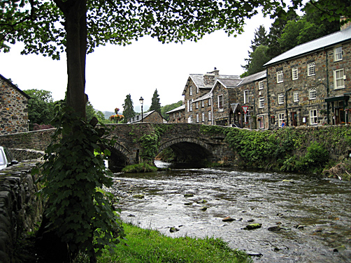
Beddgelert means Gelert’s Grave. The story goes that Llewelyn, Prince of North Wales, returned from hunting to find his faithful dog Gelert covered in blood and his son missing. The frantic Llewelyn killed the dog thinking it had killed his son. The dog’s dying yell was answered by a child’s cry. The son was unharmed, and had in fact been protected by Gelert who had slain a large wolf. The remorseful prince never smiled again and had his dog buried here. The whole story was made up by a Victorian hotelier to encourage more tourists!
The Menai Strait to Caernarfon
If you're cycling Sustrans' route 8, from south Wales to north Wales, it's worth deviating off the old railway line and dropping down to the lane that runs alongside the Menai Strait, crossing a swing footbridge into Caernarfon.


St Gybi's Well - "Oh no he's not!"

St Gybi's Well (Ffynnon Gybi in Welsh) is well worth finding. The ruined building that you see today is 18th century; the original building being bee-hive-shaped. The well itself lies behind the building; the water flowing into a small pool in the left-hand side of the building. The right-hand side being the well keeper's tiny cottage and the patients recovery room.
Dedicated to St Gybi, who came to Wales in the 6th century, the water is said to cure warts, lameness, blindness, scrofula, scurvy and rheumatism. The ‘cure’ involved drinking equal amounts of well water and sea water twice daily and then immersing in the icy pool before retiring to a bedchamber next door to sleep it off.
What we've always found amazing about this site is that holy people worshiped the crystal clean water when it came out of the ground, but then walked a mere 30 yards downstream and defecated in the stream not caring about the wellbeing of those further down the valley!
If you want to test your lover's devotion, place a handkerchief on the surface of the pool. According to local tradition, if it floats to the south it means your lover is honest and true; if it floats to the north...get back on your bike!
Location: 100 yards behind the church (map ref: SH 428 412) in Llangybi village, near Pwllheli. From the church, walk to stone stile in the left-hand corner of the churchyard. Cross stile (can be slippery) and straight ahead along left side of field and down path (slippery) into small valley and you'll see the information board next to the gate to the well.
More Ideas
New Signs
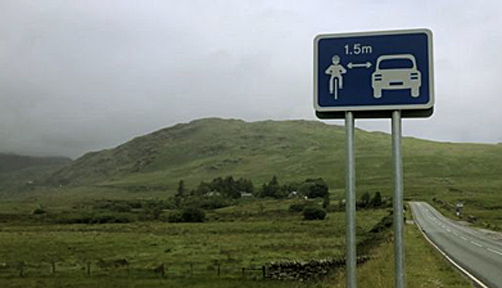
Passing distance signs have been placed on some main roads in the national park. Provided by Gwynedd council (July 2020), the signs are the first to appear in the UK.
Cycling Maps
 Sustrans
North Wales Cycle Map - shows on-road and traffic-free cycle
paths, height contours, 5 town centre maps, recommended linking
routes connecting the National Cycling Network with quiet roads.
Includes the Lôn Eifion, Lôn Las Cefni, North Wales Coast Route,
Chester to Connah's Quay Greenway. Published by Sustrans. 1:110,000
scale.
Or buy the ordinary Ordnance Survey Landranger Map from
Amazon.co.uk; scale 1:50 000 (1.25 in to 1 mile), about £9:-
Number 115 Snowdon
& Caernarfon.
Number 123 Llŷn
Peninsula.
Cycle Routes
The Visit Snowdonia website has some downloadable cycle route maps at:-
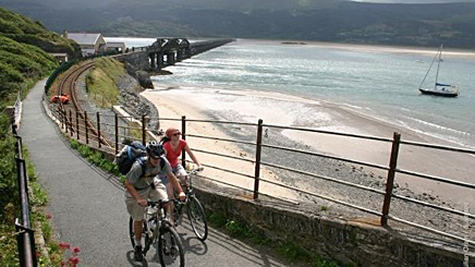
Photo: Cycling across Barmouth bridge.

