Cycling in Shropshire
Shropshire can be divided into two parts - the flatish plain to the north of Shrewsbury and the "Blue Remembered Hills" [of A.E. Houseman] to the south.
 The
northern plain was shaped by an Ice Age glacier sweeping in across
Cheshire from the Irish Sea. As the ice melted and receded the River
Severn, now unable to flow north to Liverpool Bay, formed a large
lake which eventually broke out to the south at Ironbridge, creating
the famous gorge. The glacier also left behind a ridge of terminal
moraine between Ellesmere and Whitchurch, which is great fun to
cycle over - look sideways at the mounds and dips in the fields
either side the lanes. The famous meres (lakes) of north Shropshire
were formed by melting blocks of ice creating large 'kettle' holes
which are now filled with water.

Photo: Whitemere, near Ellesmere
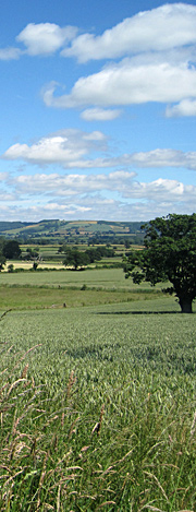
South Shropshire is a complete contrast; rolling hills and hidden valleys. The South Shropshire Hills Area of Outstanding Natural Beauty, to the south west, were designated in 1958 and cover about a quarter of the county. I (Rob) was born on a hill farm on the slopes of the Clee Hills in the south east of the county.
Ludlow
The largest town in south Shropshire, Ludlow is best know for its Michelin-starred restaurants.
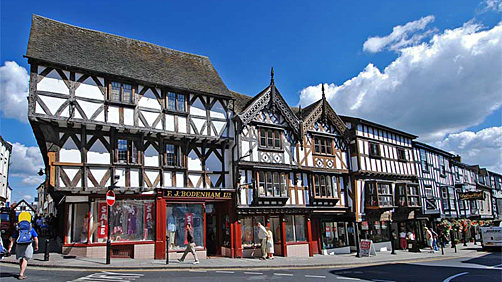
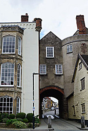
Photo: Broad Street, Ludlow.
This market town really is a gem. As John Betjeman put it, "Ludlow...is probably the loveliest town in England with its hill of Georgian houses ascending from the River Teme to the great tower of the cross-shaped church, rising behind a class market building".

Photo credit: Ludlow & Clee Hill by Ludlow.org
Cycle into Ludlow at the right time year and you can enjoy one the many festivals in the castle and around the town - the Spring Festival (in May), the Ludlow Fringe Festival (late June), the Green Festival (August Bank Holiday) and the Ludlow Food Festival (2nd weekend in September).
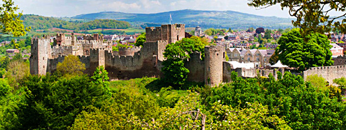
Photo credit: Ludlow castle by Ludlow Castle
Ludlow Castle has played its part in English history. Built soon after the Norman invasion, it was one of the first English castles to be built of stone. Between the 15th and 17th centuries it hosted the Council of Wales and the Marches, which governed Wales and the English counties of Shropshire, Herefordshire, and Gloucester.
Ride Ideas: We will add some routes here later.
Stokesay Castle
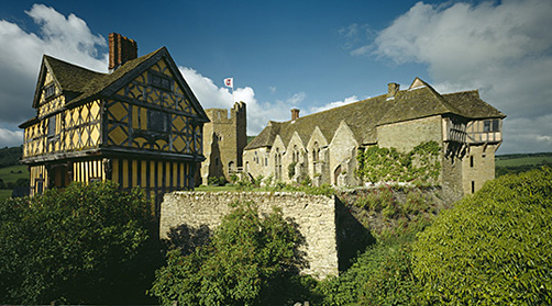
Photo credit: Stokesay Castle by English Heritage
Stokesay Castle is one of the best-preserved fortified manor houses you're likely to come across. Built in the late 13th century for one of England's leading wool merchants, Laurence of Ludlow, a rich tradesman with aspirations of becoming a country squire.
The castle was lived in until the end of the 17th century. Now in the hands of English Heritage, it is open every day, and has the all-important [for cyclists] tearoom.
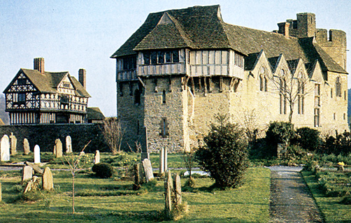
Location: on the A49 just south of Craven Arms, a small not-very-interesting town (unless you like cattle towns!).
Canals
There are 46 miles of canal in north Shropshire: the Shropshire Union Canal with its offshoots the Llangollen and Montgomery canals.
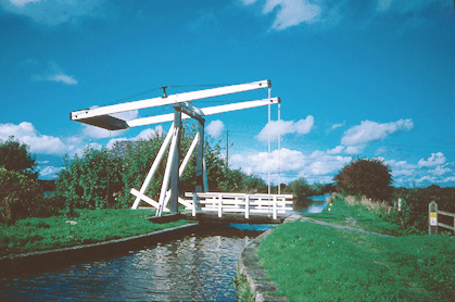
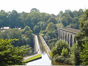
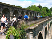
The Llangollen Canal is famous for its two aqueducts: the big one being the Pontcysyllte Aqueduct over the River Dee, and the smaller one being the Chirck Aqueduct over the River Ceiriog. Personally, we prefer the smaller more intimate one - with wonderful views up the Ceiriog Valley through the arches of the adjacent railway viaduct...

Chirk Carving
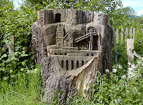
This tree stump, carved by a local man, depicts the history of the town of Chirk. The castle on top, the church, the coal winching tower, and the railway viaduct and canal aqueduct. Location: opposite the Scout & Guides building at the junction of Shepard's Lane with Trevor Road.
Also in Chirk is a rather fine war memorial carved by Eric Gill, the man who carved the David above the door of Broadcasting House. Location: opposite the junction of Church St (B5070) and Station Avenue.
Moreton Corbet Castle
Impressive ruins of a castle started about 1200, remodelled in the 16th century, and almost totally devastated during the Civil War. Walk right up close to the walls of the Elizabethan south wing (a rare example of a bold Italian-inspired design) and look up at the mullion windows.
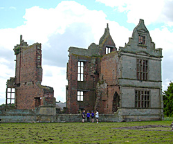
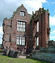
Location: near the village of Moreton Corbet, 8 miles northeast of Shrewsbury. Map ref: SJ 559 233. Post code: SY4 4DW. Free entry.
Whittington Castle
Strikingly romantic ruins; the best preserved bit being the two towers of the gatehouse.
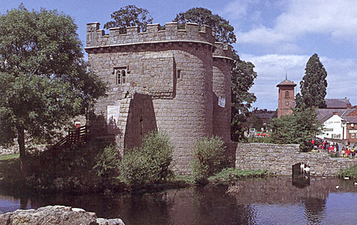
Location: in the village of Whittington, near Oswestry. Map ref: SJ 326 311. Post code: SY11 4DF. Free entry. Tea room open Wed-Sun, 10am-4pm.
Mad Jack
Jack Mytton was a famous Shropshire squire. Born rich; died poor (which I think is the right way around). Born in 1796, 2 years later he inherited the family seat of Halston Hall, Whittington, worth some £5m in today's money. With an income of over £750,000 a year (in today's money), he could afford the odd tipple - which eventually got the better of him.
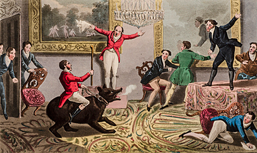
He became known as "Mad Jack" in his declining years due to his somewhat excentric lifestyle. He took to riding into nearby Ellesmere town on market day on the back of his pet bear. He rode his horse into a Leamington Spa hotel, straight up the stairs onto the balcony and jumped over the diners in the restaurant below.
On another occasion he decided to cure himself of hiccups by setting himself on fire...
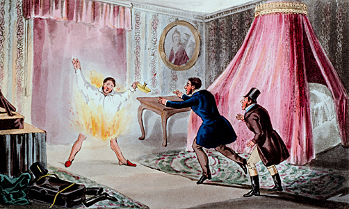
Jack spent the entire family fortune on drink, hunting, gambling, and at the races. It is said he had some 2,000 dogs, 700 hunting boots, 150 pairs of hunting breeches, 1,000 hats and 3,000 shirts. Still, he managed to have a pub named after him, The Jack Mytton Inn, so all was not lost. If you visit the canal-side pub (may be closed), at nearby Hindford village (SY11 4NL), take a look at the pictures of Mad Jack on the dinning room walls.
Sandstone Houses
North Shropshire has some rather pretty houses built with large blocks of the local sandstone. This one (near Middle) is situated in an old quarry and looks like something from Hansel & Gretel...
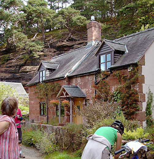
Note the precarious-looking trees at the top of the cliff-face. Apparently they don't fall down on the house and garden because of way their roots are anchored into the rock-face - they fall away from the cliff-face.
Cycling Maps

Or buy the Ordnance Survey Landranger map from Amazon.co.uk; scale
1:50 000 (1.25 in to 1 mile), about £9. Map 126
"Shrewsbury & Oswestry" covers most of north Shropshire.
Map 138
"Kidderminster & Wye Forest" covers most of south
Shropshire.
We take no responsibility and give no guarantees or warranties, implied or otherwise, for the content or accuracy of any linked sites above.

